

Making better use of water from the Brabant Wal
The water between wal and scheldt project charts freshwater flows between the brabant wal and the western scheldt in real-time to facilitate decision-making
At the base of the Brabant Wal, a sandy embankment that reaches a height of around 40 metres above sea level and which is found at the border between the Dutch provinces of Zeeland and Brabant and the country of Belgium, an annual average of 20 to 30 million cubic metres of unused freshwater flows towards the Western Scheldt. In the eyes of the relevant provinces, water authorities, and drinking water supply company Evides, this is a real waste. The project Water tussen Wal en Schelde (Water between Wal and Scheldt) encompasses their mutual search for methods to make use of this water supply, with the discharge data concept by River Insight fulfilling a key role as a source of knowledge.
Millions of litres of freshwater, slowly seeping out from the soil and in the form of direct runoff of precipitation, flows in a westerly direction from the Brabant Wal towards the Scheldt-Rhine canal, ten kilometres away. There, freshwater discharges under the main waterway and the adjacent Spuikanaal to the weir on the Brugweg, where it is sluiced into the Western Scheldt via the adjacent basins at Bath. How does the water move through those corridors following heavy rain on the Brabant Wal or during summer draughts? Is it possible to identify seasonal and inter-annual trends? And how can that knowledge help with integral regional visions on freshwater shortages, improving the quality of both the water and the environment, or other landscape functions? Using climate challenges faced by both provinces as the basis, the decision to better chart the runoff of water away from the Brabant Wal was made in 2021, as a collaboration between the provinces of North Brabant and Zeeland, the water authorities Scheldestromen (Scheldt flows) and Brabantse Delta (Brabant Delta), and drinking water supply company Evides. Since then, the Water tussen Wal en Schelde project has been part of the Delta Programme Zoet Water (Freshwater) for the 2022–2027 period, receiving annual government funding of 25%.

The Brabant Wal: a steep edge with Ice age aquifers
The subsoil of the Wal was formed during the early Pleistocene, between 2 and 1.6 million years ago. At that time, the region was an estuary that served as the mouth of the Rhine and Meuse, and both rivers would have deposited sediment there (the Tegelen Formation).
The sandy embankment has different layers of elevation and stretches from the Belgian border to Lepelstraat, where it recedes into the subsoil. At Hoogerheide and Woensdrecht, the Wal rises to a height of about 20 metres tall; at the Hoogenberg near Putte this is as much as 39.1 metres above sea level. Along its eastern side, the Wal is characterized by elevated sandy areas with forests, moors, dunes, fens, and small-scale cultivated fields and pastures. Along the western side, the Zeeland lowlands, one finds polders, with old creeks, kills, dikes, and cultivated fields. The transition from sand to clay, from dry to wet, and from high to low make the wetland comprised of Brabant Wal and the area in its direct vicinity among the richest in the Netherlands in terms of bird variety, with Lake Markiezaat being a key hatchery and resting place for countless Red List species.

Two promising subprojects
“Our job, the approach to our studies, is to see how we can make better use of water that flows from the Brabant Wal unused”, says Edwin Arens, project member and policy maker for the Brabantse Delta water authority. And that is also the aim of the Water tussen Wal en Schelde project, is the response of Vincent Klap, project member and policy maker for Water in the Zeeland province: “It does not feel right to be wasting water in this day and age.” Arens: “Moreover, we are dealing with a challenge from drying-out along the top of the Wal, as well as safeguarding environmental quality – like in the case of Lake Markiezaat”.
Klap: “For Zeeland standards, the water supply in the area along the base of the Wal is very good. There is no shortage. An ample water supply serves as a precondition for other applications. From a societal perspective, the initial reason for using freshwater runoff was as an additional supply of drinking water, but that avenue was discarded following a primary feasibility analysis. Basically, there are two promising subprojects remaining: the “Nature project”, involving water for Lake Markiezaat, and the project “Water quality & water systems optimisation”. Arens: “For the environment, it may be beneficial to redirect tributaries of water towards Lake Markiezaat. This can improve water level management, a precondition for achieving the environmental targets on and around the lake. But that kind of vision has consequences. If you want to redirect more water to Lake Markiezaat and improve environmental quality, then you will need to divert the runoff routes and install a weir. The quality of the water from the tributaries has to be good as well, and existing interests must not be compromised”.
Substantiating water management decisions
Part of the Water tussen Wal en Schelde project is charting the discharge and water quality of tributaries. Numerous small waterways, creeks, and kills discharge into the Scheldt-Rhine canal from the Brabant Wal, and on from there towards the Western Scheldt. These tributaries all have their own characteristics, such as the degree of seepage or human intervention. A more detailed insight is essential for developing plans further.
“Choosing hydrological recovery atop the Brabant Wal and retaining more water will likely lead to a decrease in the amount of runoff. We want to use a model study to reveal these kinds of things”, Arens explains. As the regional coordinator to the southwest delta, he also has a broad perspective on the supply of freshwater in the region: “Essentially, the Brabant Wal is a sponge, and its absorbent effects actually ought to be increased. Part of the rainwater runs off directly, but the water that has a chance to infiltrate only seeps out of the Wal after many years, and then flows towards the area between the Wal and the Western Scheldt”.
Klap: “We are more than curious as to the response time of increasing flows through waterways following precipitation. How long does it take after it rains on the Brabant Wal before you would see an increase in discharge and water level in an area. And in what areas? Because all of those millions of cubic metres of water discharge from the Brabant Wal through various tributaries. And although, annually speaking, this involves a great deal of water, there are also days where not a drop leaves the area through the Brugweg weir – with barely or, in exceptional circumstances, not quite enough to meet the requirements of the polders along the base of the Wal. We are curious to see whether subregions differ in terms of quality or quantity”.
Up-to-date flow data year-round
Since the start of 2023, the project partners have had seven new discharge data measurement locations outfitted with River Insight, in addition to four existing measurement stations. Thanks to year-round discharge data collection of small waterways, the project team has been gaining insight into the flow between Wal and Western Scheldt since the first quarter of 2023. Klap: “Discharge data coming in allows us to achieve a closer measurement network, thoroughly improving our insight into water quantities”. Arens: “We are in the process of structuring internal data processing in our organisation, because that is an essential part of it. How do we unlock the full potential of our discharge data, and use it in relation to each other? What are the takeaways? What does it yield? Within Brabantse Delta, we frequently ask a hydrologist for discharge data analysis”.
Arens continues: “Over the course of 2023, we will create insight into the water quality and discharge data of runoff tributaries within the research area. We want to use that insight in the individual development plans for both subprojects. With regard to final project decision-making, we will continue our integrated collaboration with the various agencies that have a stake in the Brabant Wal, which runs through multiple management areas”. Klap elaborates: “We are well-connected in the southwest delta. And the success of our integrated approach is also thanks to the Zoet Water Delta Programme”.
Perfect flow management thanks to River Insight
Discharge data measurements using River Insight in 2023 have provided the collaborating partners with insight into the discharge via tributaries and flow behaviours of the entire water management area. River Insight guarantees the management and maintenance of the seven measurement stations, and ensures an uninterrupted transmission of discharge data – as a service.
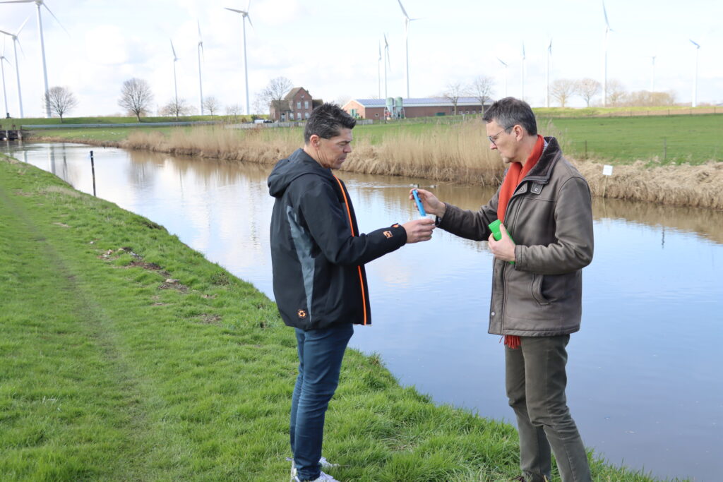
Maarten Mulder, field engineer for Nortek. “Taking intricate measurements on location using a system that is also easy to move around lets you chart a subarea in a way that was previously impossible. You can create excellent insight into water levels and discharge, and become better acquainted with local circumstances. The first raw data is already available at the end of the day of installation.”
